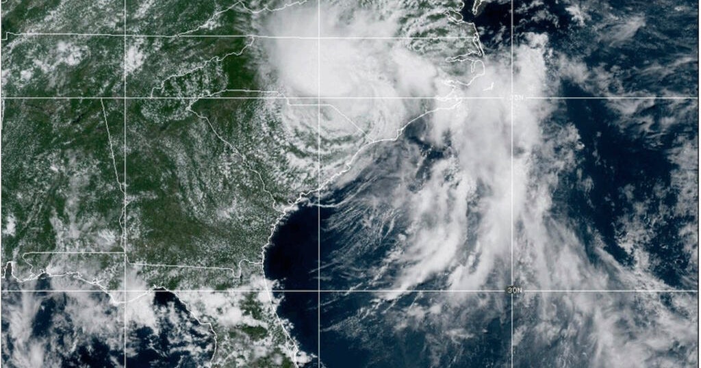
Tropical Storm Chantal was downgraded to a depression on Sunday after making landfall in South Carolina.
The system made landfall near Litchfield Beach at about 4 a.m. ET on Sunday, the National Hurricane Center in Miami said. Tropical storm warnings were canceled for portions of the two Carolinas, but heavy rain was forecast for the region through Monday.
A total of 2 to 4 inches and local amounts up to 6 inches of rain were expected to fall, raising concerns of possible flash flooding as the system makes its way north. Flood watches were issued for central North Carolina and south-central Virginia through Monday.
“The Haw River at Bynum in Chatham County is now forecast to crest near 21.2 feet at around 8 a.m. Monday morning,” said Jonathan Blaes of the National Weather Service on Sunday night. “At 9:31 p.m., the river was at 17.0 feet and the river had surged up more than 4 feet during the past hour and 7.7 feet over the past two hours. This crest is just below the all-time crest or flood of record of 21.8 feet set during Hurricane Fran.”
Chatham County, North Carolina, said on its official X account that part of NC Highway 902 near Chatham Central Rd. had collapsed.
“Over 100 roads across the county are flooded, and flooding is expected to continue through tonight and tomorrow—even after the rain ends,” the county said.
Chatham Emergency Management Director Steve Newton told CBS News on Sunday Night that the rain had moved out of the area but stranded motorists were still being rescued. Several homes had been struck by trees but there were no immediate reports of injuries, Newton said.
Residents living along the Haw River in homes that could become isolated by flooding were being notified door-to-door about the danger, Newton said.
At 11 p.m. ET, Chantal was located about 60 miles southeast of Danville, Virginia, and was moving northeast at 12 mph with maximum sustained winds of 30 mph. The system is expected to keep moving northeast as it weakens further.
Forecasters said dangerous surf and rip currents at beaches from northeastern Florida to the mid-Atlantic states are expected to last for the next few days.
South Carolina’s Emergency Management division had warned residents earlier of the possibility of isolated tornadoes along the coast and of minor coastal flooding.
It also warned drivers not to venture on water-covered roads or around road closure signs where flooding occurred.
The Atlantic hurricane season is from June 1 until Nov. 30, with peak activity typically occurring between mid-August and mid-October.
NOAA officials predicted a 60% chance of an “above-normal” Atlantic hurricane season, with between 13 to 19 named storms. Six to 10 of those are expected to strengthen into hurricanes, and three to five could become major hurricanes, forecasters said.
contributed to this report.